

As of January 1, 2024, all climbers above 9,500' in the Mt. Hood National Forest are required to carry a permit. As a Mazama member, if you are accepted onto this climb, your permit will be included with your registration—you will not need to arrange your own climbing permit.
The highest point in Oregon, this route gets the vast majority of Hood ascents. A weekday climb during prime season (early May - late June) can avoid most of the crowds.
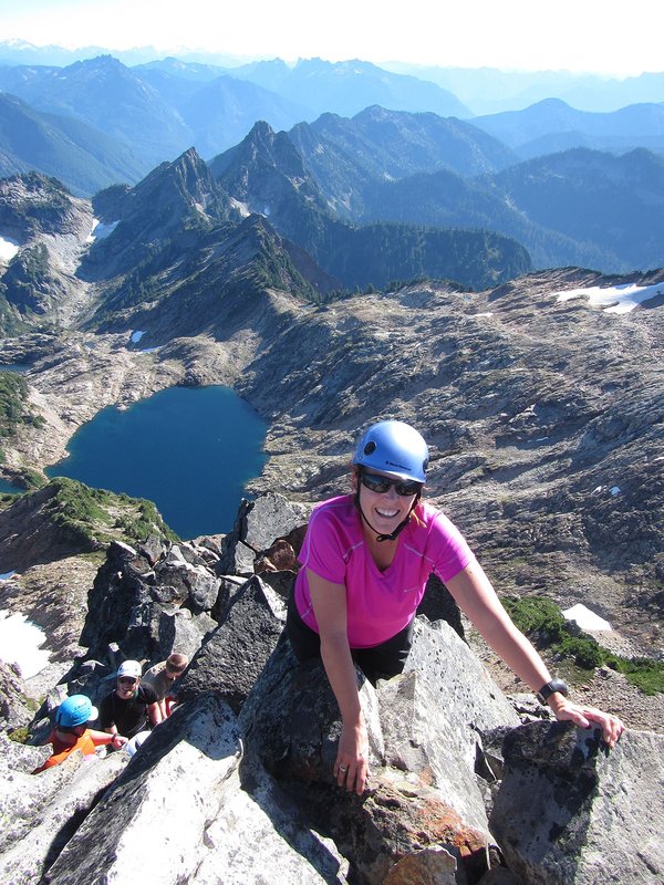
The South Side is a general term for several different "chutes" on the south side of the mountain, including the Old Chute, Mazama Chute, and Pearly Gates. The most popular route on an given season depends on the snow accumulation and snow conditions.
The Pearly Gates was the most heavily used route to the summit of Mt. Hood until 2006 when a dramatic shift in the Hogsback and the increased steepness of the this route made the Old Chute the more typical ascent route. The left chute of the Pearly Gates offers a short "step" of steeper snow/ice climbing, while the right chute of the Gates can offer several steps of steeper snow/ice. You cross over the bergschrund to get into the Gates. You can descend by rappelling or downclimbing the route, or by traversing over to the Old Chute.
The Old Chute is a great route to ascend if the bergschrund is impassable or Pearly Gates are jammed with people.
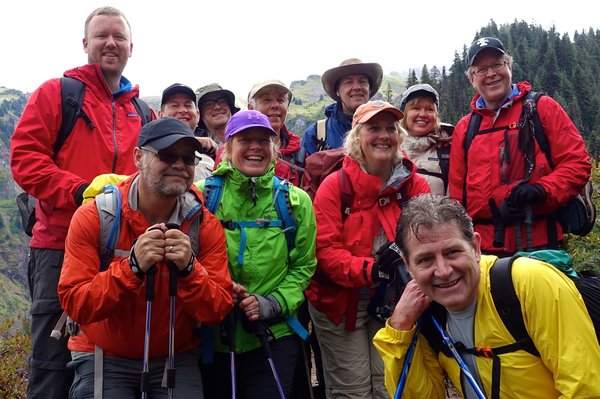
Activity Notes
UPDATE: I am reopening this climb as it has been rescheduled twice, and the roster has had to change because of that. Feel free to apply if you have the skills in the description. I will probably take up to 2, maybe 3 additional folks.
This is for AT skiers and splitboarders only. I would like to take no more than six total, including myself.
We'll skin up from Timberline (possibly with ski crampons, so have them) until we can't anymore, at which point we will boot up with boot crampons. This will likely be either at Devil's Kitchen, or at the top of Palmer. We may take the West Crater Rim route to avoid the crowds. We will then likely head up Old Chute to the summit, and back down the way we came (though a prusik rappel down Mazama Chute is possible), skiing one at a time down to Palmer, and then as a group within eyesight of each other on the groomers to the lot.
Any questions about whether you are qualified or not can either be emailed (dforestation@gmail.com), texted, or you can call me. (360)440-9830.
If the weather and/or conditions don't cooperate, this can may get kicked down the road, since it has already been twice.
IF YOU ARE IN L.D. AND YOU WANT AN EVAL TO ASSIST, HIT ME UP!
| Other Information | |
|---|---|
| Driving Distance from Portland | 65 miles |
| Driving Time from Portland | 1 hours |
| Distance - Round Trip | 6 miles |
| General Route Info | This is the standard and most commonly climbed route on Mount Hood. Proximity to ski lifts makes returning to the trailhead and low visibility substantially easier. Photographs taken at the turn of the century show the Hogback in the position it is found in today. Photographs taken during the 1920s, 1930s, 1940s, and 1950s show the Hogaback shifted sharply to the west and significant reduced in size. Sometime during the 1960s the Hogback again shifted east to its current position and grew in size. In 1930s the gully which led from the top of the Hogback to the summit became known as the Chute. When the Hogback shifted back toward the east in the 1960s, climbers followed it and started to use a different gully to gain the summit. Although the route was different, it was still called the Chute. To distinguish between the two, the term Old Chute means the route to the west. From the Hogback, climb diagonally up and left on a steep face which leads to the summit ridge. Turn right and follow the ridge to the top. When you reach the top of the Old Chute, do not be surprised by the narrowness of the ridgetop and the sharp drop down the north face. -From Oregon High by Jeff Thomas |
| Expected Duration | Car to car in one day |
| Relevant Books | Oregon High by Jeff Thomas |
| Relevant Maps | USGS 7 1/2 minute series, Mt Hood South, Green Trails Mt. Hood, Geo Graphics Mt. Hood Google map https://www.google.com/maps/@45.3704953,-121.7015928,15.02z/data=!5m1!1e4?hl=en |
| Awards Qualified | 16 Major NW Peaks, Guardian Peaks, Seven Oregon Cascades Peaks |
| Useful Links | GPS Track GPS Coordinates Map |